
Event reports
-
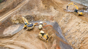
What are the foundations to your remediation?
Earthworks, or the use of engineered fill, is now a frequent activity as sites need to be prepared before house building can take place. In this Network event, speakers from NHBC’s Land Quality Service team explained the newly published addition to the NHBC’s Standards, Chapter 4.6 - Engineered Fill.
View the report -
Increasing the protection from radon gas
As construction and installation methods change, guidance on protective measures against radon gas intrusion needed updating. At our online Brownfield and Regeneration Network event, a range of speakers outlined the changes to BR211: Guidance on Protective Measures for New Dwellings
View the report -
Evaluating remediation benefits through natural capital
This Expert Talk, held in partnership with Jacobs, the Environment Agency (EA) and the British Geological Survey, presented current research conducted for the EA on the development of a novel natural capital approach. This approach is used to evaluate the sustainability benefits from remediating and redeveloping contaminated brownfield sites.
View the report
News analysis
-
 Brownfield
MIPIM: key regeneration launches
The property and developer event MIPIM (le marché international des professionnels de l'immobilier) concentrated on quality above quantity this year and there were important regional regeneration launches. Ian Grant reports
-
 Brownfield
Brownfield review: Wolverhampton | Wirral | Dudley | Leeds | Worthing
Four teams selected for iconic Wolverhampton brownfield, while Wirral Council given nature grant to stop flooding, Future High Street Living buys ex-industrial site, Caddick gets approval for mixed use on Leeds South Bank and Homes England unlocks regeneration potential in Worthing
-
 Brownfield
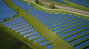
Renewables and energy storage on brownfields rising
Several applications and studies for renewable energy systems and storage on brownfields and landfills reveal an increasing underlying trend
-
 Impact assessment
Vapour intrusion mystery investigated
Campbell Reith (CR) was faced with investigating a potential Part 2a site involving vapours from a chlorinated solvent plume which had migrated off site beneath existing residential buildings in complex geology. In this webinar, CR partner Simon Burr explains the techniques used from multi-level boreholes to in-house vapour monitoring and how the communication strategy was vital in gaining access to the homes.
Events
-
 awards
Sustainability Delivery Awards Ceremony
Boston, MA -
 awards
Brownfield Awards Ceremony 2024
Kimpton Clocktower Hotel, Manchester